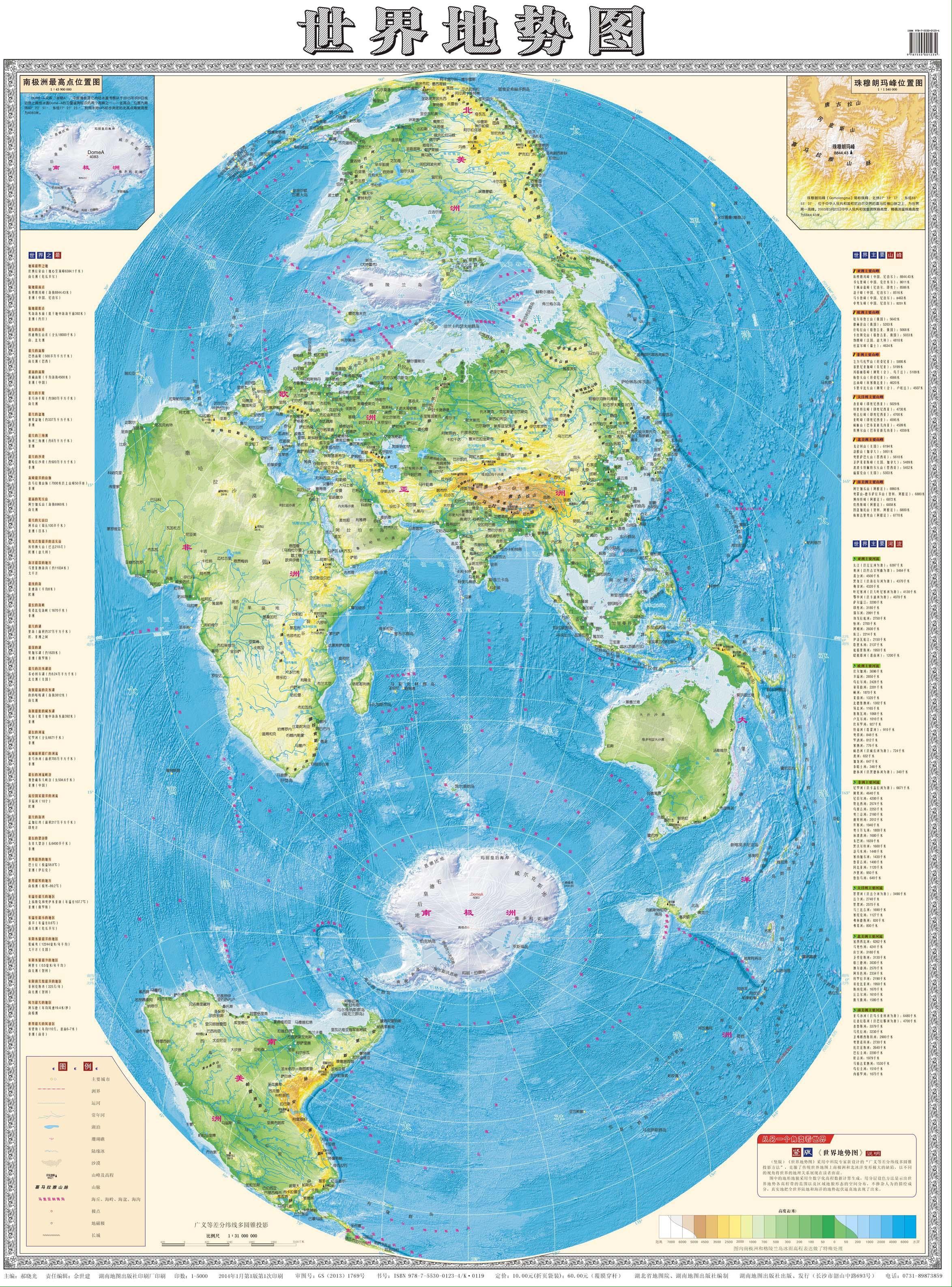
Blaze (he/him)@sopuli.xyz to Map Enthusiasts@sopuli.xyzEnglish · 4 months agoWorld map from China, first time I see this projectionfiles.catbox.moeimagemessage-square78fedilinkarrow-up1534arrow-down114
arrow-up1520arrow-down1imageWorld map from China, first time I see this projectionfiles.catbox.moeBlaze (he/him)@sopuli.xyz to Map Enthusiasts@sopuli.xyzEnglish · 4 months agomessage-square78fedilink
minus-squarenednobbinslinkfedilinkarrow-up8·4 months agoWhen I was a kid, a lot of US maps where US-centered. They would chop Eurasia down the middle and include some overlap on the edges (so places like India might show up twice).


When I was a kid, a lot of US maps where US-centered. They would chop Eurasia down the middle and include some overlap on the edges (so places like India might show up twice).