You do need to understand the context of the situation. During the last seconds of all flights the helicopter attempts to send back an extensive summary of data relating to the specific flight, it also returns up to ten images of the descent from the NavCam. Some of that data is shared with the public in the form of JSON data on mission specific URLs. At the end of flight 53 on July 26, 2023 the JSON data for the helicopter was not updated, nor were any landing images of the flight posted on the mission image server. Communication conditions from the beginning of July to the present day have varied between good and perfect. I have just counted the images received from the helicopter since the beginning of July, it’s 1,611. 657 of those images arrived after the 53rd flight landed, but none of the images were from the 53rd flight. Even today we have had about 200 images from the older flights (clearing the backlog stored on the helicopter). A couple of drives ago the rover arrived close to the 52nd landing site, the post-drive images showed the helicopter was not there, this was the publics first confirmation the 53rd flight had at least taken off. Those end-of-drive images are normally binned using 4 tiles (2x2) that form a 360 degree view around the rover. At the end of that drive the rover acquired each image using 16 tiles (4x4) 4 times the standard resolution, so I assume they were looking for the helicopter as they had no idea where it was from the limited data they had received near the end of the flight. That includes its ‘localization’ data. The helicopters navigation system knows where it is, during the flight it uses its IMU, laser altimeter and 10 images per second to update its location. JPL have not told us, but it is becoming increasingly obvious that the localization was corrupted or lost during the flight. It reached an altitude of 5 meters (plan: 10m) flew 142.5 meters (plan 203.1m) Duration 74.9 seconds (plan 136.82). The missing data includes Yaw, Pitch, Roll, Tilt and all the Unit Quaternion data. So I believe they have since told the helicopter where it is, and the ‘hop & hover’’ flight 54 will reset the IMU, so they can verify its data at the end of the test flight and check all of the data is returned. Fingers crossed it all comes back.
Some of this may be the effects of being in radio dead zone for 63 days after landing flight 52. The Heli does not generate enough power to heat itself overnight, so the batteries and electronics get a good chill down overnight every night, the computer resets and has to await a charge before rebooting the next morning, not perfect conditions for the consumer grade hardware / instruments. We already lost the inclinometer many months ago, if the IMU is aging it would not be a good thing. The helicopter team has shrunk dramatically since landing so we (the public) get little information and the flight plans are as you have seen very cryptic, so we sometimes have to read between the lines. Apologies for a lengthy reply but I hope it answered your question.
@paulhammond5155@isaiah It’s still super interesting they use a smartphone processor(Qualcomm Snapdragon 801 to be exact) on Ginny and that’s it’s holding up so well!

That’s an oddly cryptic post from the NASA team, no? Maybe I missed an explanation somewhere about what exactly “localization” means in this context.
You do need to understand the context of the situation. During the last seconds of all flights the helicopter attempts to send back an extensive summary of data relating to the specific flight, it also returns up to ten images of the descent from the NavCam. Some of that data is shared with the public in the form of JSON data on mission specific URLs. At the end of flight 53 on July 26, 2023 the JSON data for the helicopter was not updated, nor were any landing images of the flight posted on the mission image server. Communication conditions from the beginning of July to the present day have varied between good and perfect. I have just counted the images received from the helicopter since the beginning of July, it’s 1,611. 657 of those images arrived after the 53rd flight landed, but none of the images were from the 53rd flight. Even today we have had about 200 images from the older flights (clearing the backlog stored on the helicopter). A couple of drives ago the rover arrived close to the 52nd landing site, the post-drive images showed the helicopter was not there, this was the publics first confirmation the 53rd flight had at least taken off. Those end-of-drive images are normally binned using 4 tiles (2x2) that form a 360 degree view around the rover. At the end of that drive the rover acquired each image using 16 tiles (4x4) 4 times the standard resolution, so I assume they were looking for the helicopter as they had no idea where it was from the limited data they had received near the end of the flight. That includes its ‘localization’ data. The helicopters navigation system knows where it is, during the flight it uses its IMU, laser altimeter and 10 images per second to update its location. JPL have not told us, but it is becoming increasingly obvious that the localization was corrupted or lost during the flight. It reached an altitude of 5 meters (plan: 10m) flew 142.5 meters (plan 203.1m) Duration 74.9 seconds (plan 136.82). The missing data includes Yaw, Pitch, Roll, Tilt and all the Unit Quaternion data. So I believe they have since told the helicopter where it is, and the ‘hop & hover’’ flight 54 will reset the IMU, so they can verify its data at the end of the test flight and check all of the data is returned. Fingers crossed it all comes back.
Some of this may be the effects of being in radio dead zone for 63 days after landing flight 52. The Heli does not generate enough power to heat itself overnight, so the batteries and electronics get a good chill down overnight every night, the computer resets and has to await a charge before rebooting the next morning, not perfect conditions for the consumer grade hardware / instruments. We already lost the inclinometer many months ago, if the IMU is aging it would not be a good thing. The helicopter team has shrunk dramatically since landing so we (the public) get little information and the flight plans are as you have seen very cryptic, so we sometimes have to read between the lines. Apologies for a lengthy reply but I hope it answered your question.
Yeah, very thorough answer - thank you! Super interesting situation. Fingers crossed!
Someone just shared this with me… It has more depth - https://picknik.ai/slam/localization/state estimation/mars helicopter/2021/05/10/Ingenuity.html
@paulhammond5155 @isaiah It’s still super interesting they use a smartphone processor(Qualcomm Snapdragon 801 to be exact) on Ginny and that’s it’s holding up so well!
I have to admit I thought they would be lucky to survive a few months… Yet, here we are >2 years on
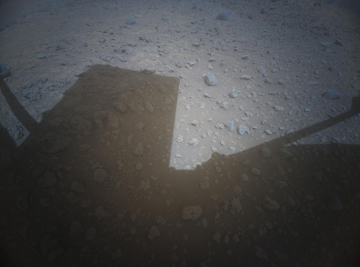
BTW - Just got some of the flight 54 images