https://www.histouring.com/en/historical-places/niederfalkenstein/
https://www.openstreetmap.org/way/372935536 Street view: https://goo.gl/maps/wmknYbTeXCpXcVQc8
Today the castle is private property, but can be visited in summer.
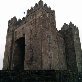
The fortification was erected on a rocky promontory on the southwestern slopes of the Reisseck Group in the Hohe Tauern mountain range, overlooking the Möll valley east of Obervellach. Niederfalkenstein is 843 metres (2,766 ft) above sea level.
The Tauern Railway line, opened in 1909, initially passed under the rock in a 67-metre (220 ft) long tunnel. In the course of the double-tracked expansion carried out from 1971 to 1973, the rail tunnel was replaced by a wide arch bridge, the present-day Falkenstein Bridge passing between Ober- and Niederfalkenstein, with 396 metres (1,299 ft) the longest of the line and one of the longest in Austria.
The ruins of Oberfalkenstein comprise a Bergfried keep with surrounding moats and the foundations of a Romanesque palas. A chapel dedicated to John the Baptist was first mentioned in 1246, significantly enlarged in a Baroque style in 1772 and is still in use.
Love the green fist that’s been growing there. It’s a rebel base for sure.
Haha, never looked at it like that. That’s great.


