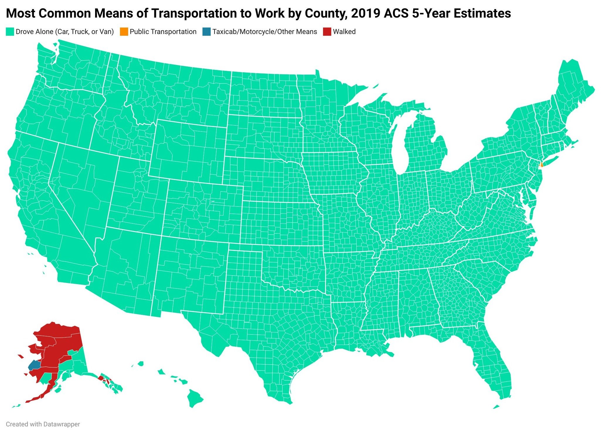
That’s just an example of how useless the map is. You can’t look at it at this scale and only pay attention to the top most used transportation from a county level. New York City shows up because it literally is those counties, geographically, nearly edge to edge.

That’s just an example of how useless the map is. You can’t look at it at this scale and only pay attention to the top most used transportation from a county level. New York City shows up because it literally is those counties, geographically, nearly edge to edge.