
- cross-posted to:
- globalnews@lemmy.zip
- china@sopuli.xyz
Cross-posted from: https://feddit.de/post/10664616
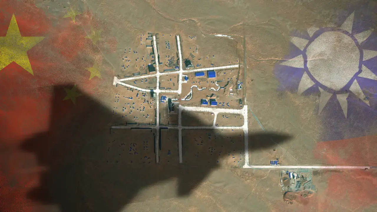
The satellite images reveal a layout of streets strongly resembling the Bo’ai Special Zone, a restricted area in Taipei’s Zhongzheng District that houses Taiwan’s most important state buildings, including the presidential palace, the supreme court, the ministry of justice and the central bank of Taiwan.
The Bo’ai Special Zone is subject to specific regulations, including a strict ban on overflight.
That doesn’t look like a satellite image
Why not?
Satellite photos are high resolution, capturing large areas at a time, which means stuff off-center is not captured perfectly orthogonal. Not sure you could tell between a satellite, high altitude balloon, or U-2 photo, just from a cropped piece of it.
You can see the shadow of the plane
The plane’s shadow wouldn’t be that big. Because the sun is so far away the plane’s shadow would be the same size as the actual plane (at most a bit stretched when the sun is low). Whereas this is purported to be a life-size mockup.
The plane overlay is probably just added for dramatic effect. The kilometers-long flags are obviously not really there either. And after all, which foreign nation overflies China with military planes? It must have been a sat, not a plane.
And two flags, both added with image editing, and transitioning into transparency.
If you take the fighter jet shadow as true size, then the training compound is so small you would crush it below your feet.
deleted by creator
It’s edited. https://www.businessinsider.com/china-built-mock-up-taiwans-presidential-office-area-desert-images-2024-3